
CASE STUDY — Archaeological Exploration
INVESTIGATION OF AN ARCHEOLOGICAL SITE REVEALED BY AN AERIAL SURVEY
Use of state-of-the-art GPR software produces intriguing subsurface imagery of a buried medieval structure in Hungary
Project Impacts

Modern GPR technology was used to confirm the existence of a significant archaeological site – without excavation
The distinctive round shape of a large ditch in eastern Hungary gave rise to speculation that it may indicate the presence of an important archaeological site – and the remains of what is believed to have been a church from roughly 1000 years ago could be evaluated without the need for excavation work which could damage or disturb the find.

The remaining structure could be visualised in 3D images, giving insights into its history
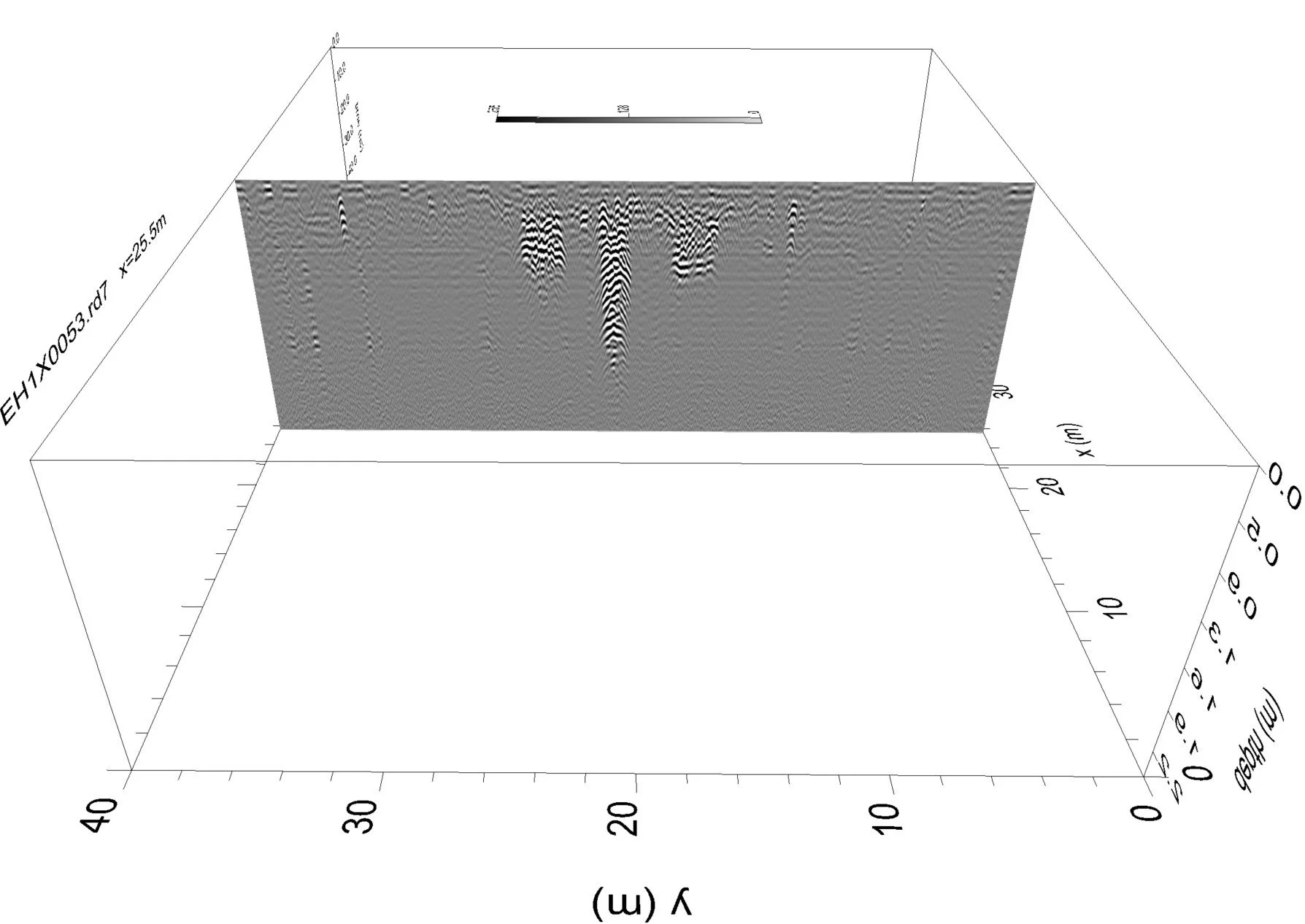
The use of GPR Slice software to analyze and visualize the GPR data revealed the details of a round feature at the center of the church, much deeper than the foundations, which is believed to be a stone well – a quite unusual feature for a rotunda church of this type (typically dating from the 9th to the 13th century) and most likely used for baptisms, giving an indication of the size and practices of the population the church served at the time of its construction.
Facts & Figures
48%
In a UK study, 48% of land with archaeological monuments has revealed some evidence of destruction of the archaeological remains since 1945.
< 25%
In a review of archaeological site destruction attributed to land use and land cover change in Peru's lower Moche Valley between 1985 and 2020, less than a quarter of the over 400 archaeological sites previously recorded were found to remain on the landscape.
TECHNOLOGY OUTPUTS
-
![]()
Plan view of the buried structure
The analysis of the ground-penetrating radar data using GPR Slice enabled the buried structure to be visualized without carrying out excavation work which would disturb and potentially damage the find -
![]()
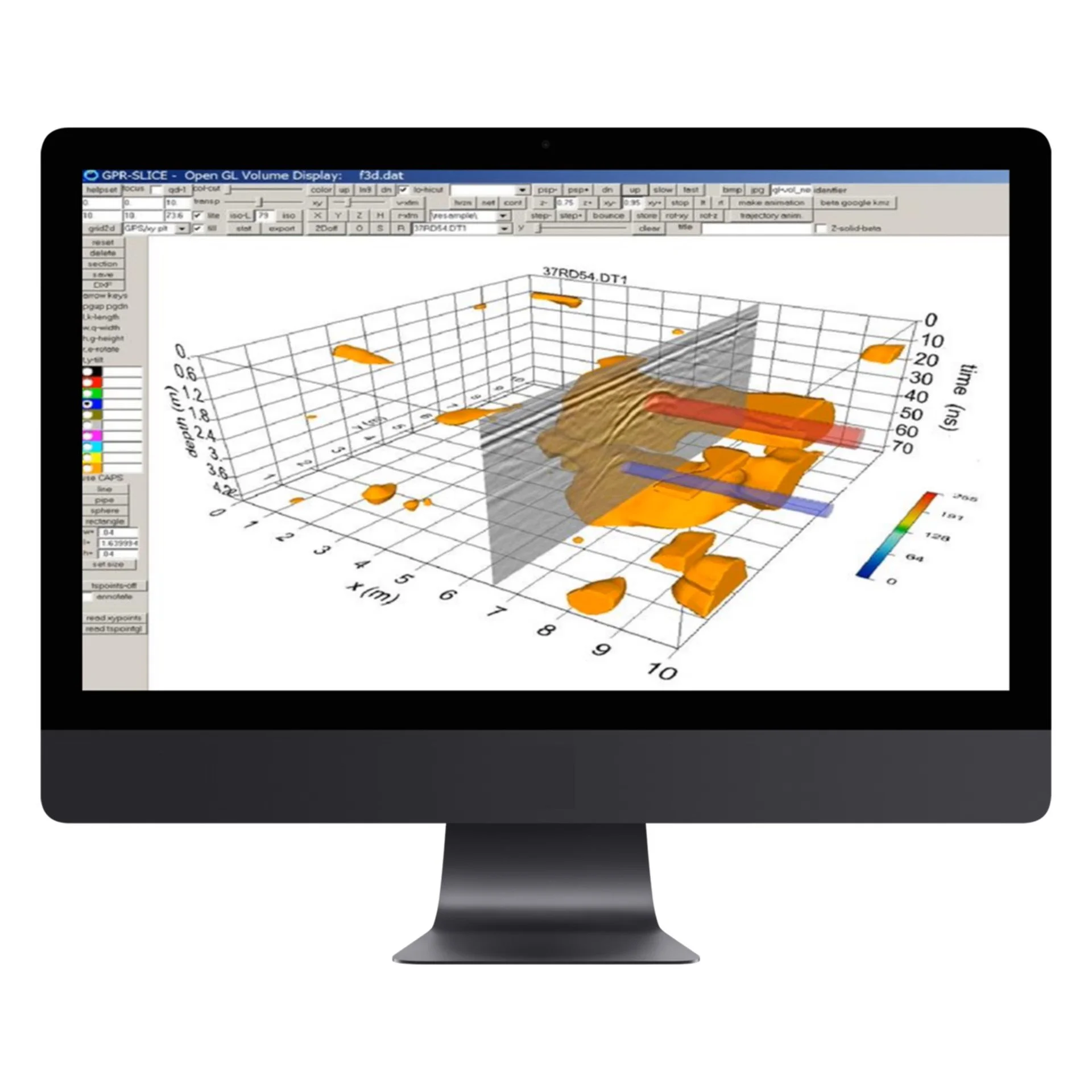
3D imaging of buried structure from any angle
The ability to analyze the imagery from any angle enables archaeologists to gain deeper insights from the data provided by the GPR survey -
![]()
2D imaging of any vertical or horizontal section through the buried structure
The “slicing” of 3D imagery using GPR Slice, producing 2D sections, provides additional insights that may be invaluable in facilitating the best evaluation of the site before any hole is ever dug in the ground
EQUIPMENT
-
![]()
GPR scanning equipment such as the Proceq GS8000
can be used to establish the existence, layout and dimensions of subsurface objects – including the foundations of ancient structures -
![]()
GPR Slice software
facilitates in-depth analysis of ground-penetrating radar data for greater understanding

THE CHALLENGE
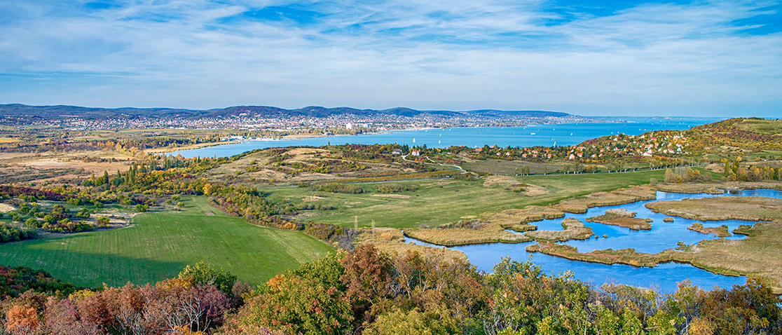
When a large ditch with a distinctive, perfectly round shape was spotted on aerial photography near Lake Balaton in western Hungary, the Hungarian National Museum set out to investigate. The country has an impressive legacy of archaeological structures dating from the Roman era to the late medieval age – a valued heritage, both locally and nationally. But how to proceed to investigate such a site? Without knowing what is hidden beneath the ground, should the investigators simply start excavating?
AQUILA’S SOLUTION
High-tech analysis of subsurface scanning data facilitates investigation of buried structures without exposing them and risking damage
The use of modern ground-penetrating radar (GPR) technology to scan the ground, providing imagery of what lies beneath the surface, offers many benefits. This approach can provide a good understanding of the size and shape of buried structures and other subsurface features without exposing them and risking damage – either during the excavation work or at any point in the future. GPR scanning using equipment such as the Proceq GS8000 is far quicker and much more cost-effective than widescale excavation work, and enables the significance of a site to be easily established. And if excavation is found to be warranted, the GPR imagery can enable the work to be carried out in a targeted, careful way that minimizes risks to the find.
Following completion of a GPR survey, the data was processed and visualized using GPR Slice software. This high-tech software, which was specially developed for archaeological applications, provides improved visualization of the scanned data, supporting deeper insights into the subsurface find. Its use can therefore be very significant in helping the responsible historian to decide whether and to what extent a find should be protected and preserved.
CLIENT BENEFITS
Advanced visualization of GPR data maximizes understanding of what can be established from non-destructive subsurface scanning
Post-processing and visualizing the GPR data using GPR Slice software revealed a peculiar round-shaped feature with an extension to the east. This led the historians to believe that the foundations are most likely the remains of a rotunda church – a type of structure that was most common in central Europe from the 9th to the 13th century.
However, this church had some strange features. Apart from the large ditch around it, which is not typical of these buildings, the middle of the church is also intriguing. The GPR Slice visualization of the data reveals details of a round feature at the middle of the church going much deeper than the foundations. The archaeologists believe that this is a finely built stone well with brim, which is quite unusual in a church of this type. It is suspected that a well in the middle of the church like this was probably used for baptisms, giving some indication of the size and practices of the local population at the time of the church’s construction.
In addition to the insights that have already been gained through the use of GPR Slice, the visualizations provided will also be of great value when the time comes to conduct further investigations – enabling these to be targeted for best results and ensuring that excavation work does not damage fragile archaeological objects. The project thus demonstrates the great contribution that modern GPR technology can make to archaeological investigations – especially when coupled with GPR Slice data analysis software.
-
Country: Hungary
Region: Lake Balaton
-
Screening Eagle technology:
• GPR Slice
Technology used:
Application type:


Aerial imagery revealed an intriguing anomaly near Lake Balaton, Hungary, sparking the curiosity of the Hungarian National Museum

The GS8000 ground-penetrating radar (GPR) device facilitates quick and easy investigation of what lies beneath the ground, with immediate visualization on the user’s iPad

GPR Slice technology was also used to carry out an archaeological analysis of King Tutankhamun’s burial chambers in Egypt


